
This article covers the following topics:
Related articles:
Suitability Corridor Explanation
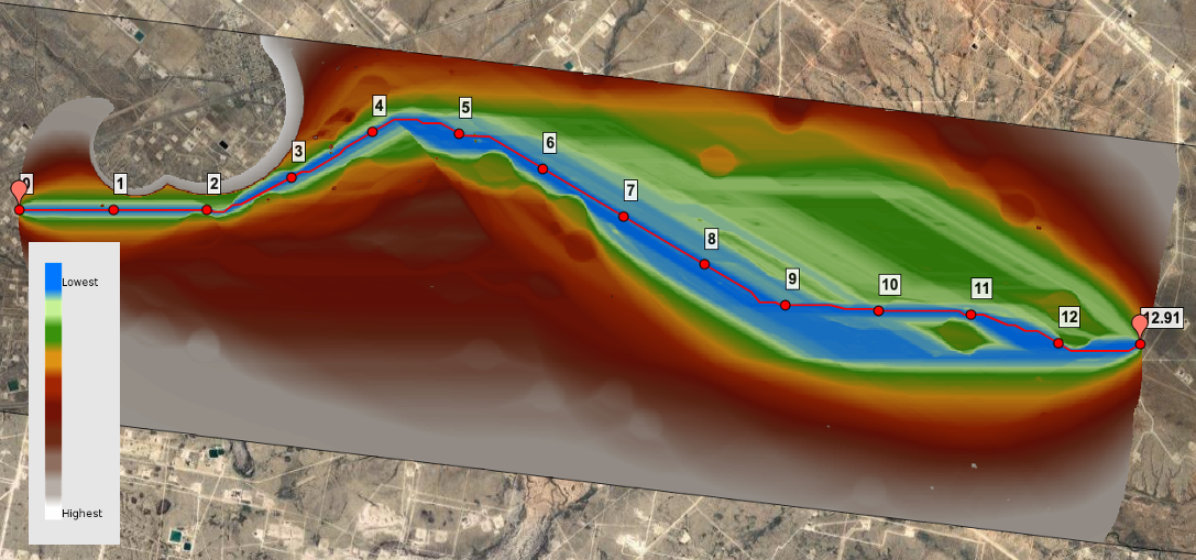
When Pivvot creates a system-generated route, it is calculating the "least cost" path between two or more objectives based on the preferences configured in the PLAE. As part of that process a Suitability layer is created which provides a graphical representation of the relative "costs" (Prefer, Low Avoidance, Avoid, Exclude) configured in the PLAE. The Suitability Corridor map provides an alternate way of visualizing opportunities within the AOI. This map layer display possible corridors based on the least cost path derived from the Suitability map and the project's objectives.
As seen in the image below, the blue represents areas that are the most similar to the corridor for the system-generated route ("least cost path").
You will also notice the Suitability Corridor layer reveals where other possible corridors exists within the AOI (see the image below), again based on the project objectives and PLAE configuration.
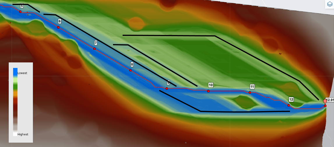
Using the Suitability Corridor layer in conjunction with the Digitize Route feature enables you to identify and create possible routes that would otherwise not be provided through the system-generated, least-cost path process.
How to Generate and View the Suitability Corridor
Suitability Corridors are only available for system-generated routes. You cannot generate a Suitability Corridor map layer for Uploaded or Digitized Routes.
Suitability Corridors are created as part of the typical Route workflow. For more information about any part of this workflow, please refer to the Related articles listed above. To Create and view a Suitability Corridor, do the following steps:
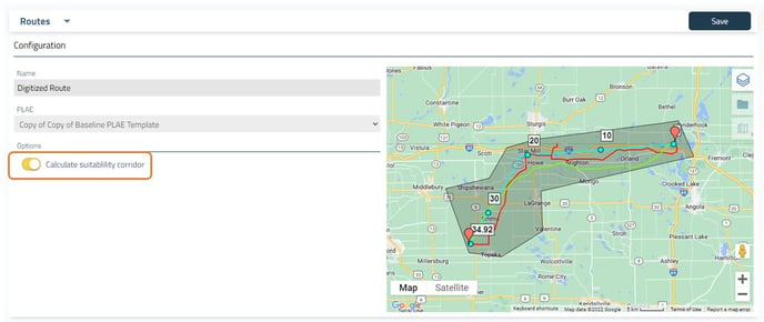
- While configuring your System-Generated Route on the Routes page, enable the "Calculate suitability corridor" toggle
- Generate the route, as detailed on the Deliverables page.
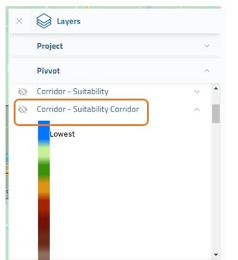
- Once the route has been generated, you will see a new data layer in the Data Layers flyout with the name of your route and the suffix "- Suitability Corridor". This map layer can be enabled in the same way as any of the other data layers that are available.
- This data layer can now be viewed from many of the pages within Pivvot's Route application.