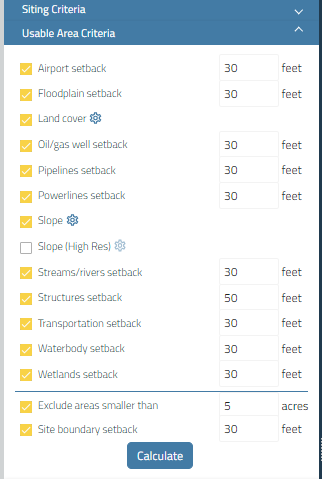
Usable Area Criteria Panel
The calculation of Usable Area takes into account several constraints. Each of these constraints can be enabled or disabled. You can also modify the setback distance, as well as adjust land cover subtype avoidance and slope avoidance.
The Usable Area Criteria panel is located just below the Siting Criteria panel on the left of the screen.
Land Cover and Slope
Land Cover and Slope are the two Pivvot constraints that you can edit. To do this select the settings button  .
.
For example, once the settings button is selected next to Land Cover, a window will pop up with the land cover subtypes. In the example below, forest is considered usable for our project, so the middle arrows were used to move it from the "is not considered usable" to the "is considered usable" column.
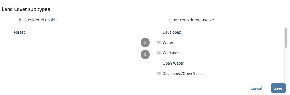
Once you have selected the useable and not useable land cover types, click the save button.
For more information on configuring slope in your usable area criteria, see Configure Slope and Aspect in Usable Area.
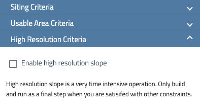
Slope (High Res): High Resolution Criteria
The High Resolution Criteria panel is located below the Usable Area Criteria panel, and this is where you can turn on and configure the high resolution slope for your sites.
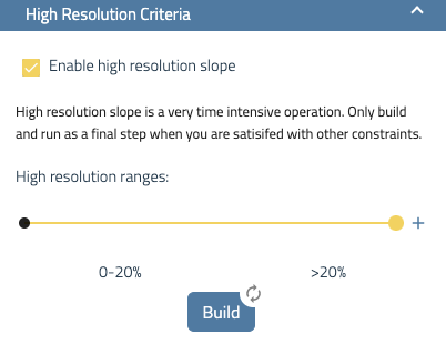
Once enabled, you can edit and create custom ranges to span anywhere from 0% to a maximum of 20%.
High resolution slope is a time intensive computing process, so it is best to consider it a final step once you have a site you are interested in.
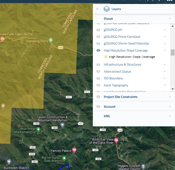
High Resolution Slope Coverage
To determine if an area has high resolution slope available, you can easily check by activating the High Resolution Slope Coverage layer in the Pivvot layers flyout. This feature is only accessible in areas that have been mapped with 3 meter DEM coverage. By turning on this layer, you'll be able to see if the high resolution slope is available for the specific location you're interested in.
For further questions, reach out to support@pivvot.com