This article covers the following topics:
Deliverables
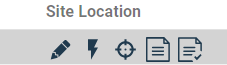
Located at the top left corner of the Project Sites tab are most of the deliverables you can download. These deliverables include a Data Package, web-based report, a Contact List, a Siting Constraint Report, and a KMZ.
Data Package
Select the “Create Data Package” icon – This will bundle and download all project data. This download will contain all Pivvot data that relates to your project in a .gdb, a folder of project sites with 3m elevation resolution, 10m elevation resolution, and a folder relating to landcover. Each folder contains an aspect surface, elevation surface, and slope surface in .tif format for each of your project sites.
Web-Based Report
To generate the web-based Report, select the “Create Report” icon – This creates a report that is viewable in the report console. Selecting the icon to generate this report will give you a warning notice that it may take several minutes to generate. Once the report is generated, click on the icon to view it.
Contact List
To download the Contact List, select the “Create Contact List” icon – This will download a list of all contacts associated with your project sites. This package will include an Excel Spreadsheet with landowner information as well as image files for either each tax map parcel or each site (one to many tax map parcels) contained within the project. You can control if you want images based on the tax map parcel or for each site using the drop down menu located to the right of the "Create Contact List" icon .

Siting Parcel Report
To download a PDF Siting Parcel Report, you first need to generate it for a specific site in the Project Sites tab. For detailed instructions on how to generate this report, please refer to the article titled Project Sites Tab.
Once you have generated the parcel report for a particular site, you can easily download it by clicking on the "Download parcel report" icon. If you have generated parcel reports for multiple sites, you will have the option to choose which site's parcel report you want to download. This allows you to efficiently access the specific information you need for each site.

Your account admin can configure datasets represented in the Siting parcel report using the Publish application. The account admin can also upload a company logo to further customize the report. For more information, go to Account Admin Overview.
KMZ Download
To download a KMZ file, simply click on the "Download a KMZ" icon. This will generate a KMZ file that includes the project area, the usable area (if calculated), and each constraint in its own separate layer. The KMZ file will also contain valuable attributes such as the name, rank, and status of each constraint.
![]()
Siting Permitting Report
In addition, you can download a Permitting Report for a site by selecting the “Download Permitting Report” icon the Site Location column in the Project Sites tab.
This Permitting Report will include a list of federal permits that may be triggered based on the available data at a given site.